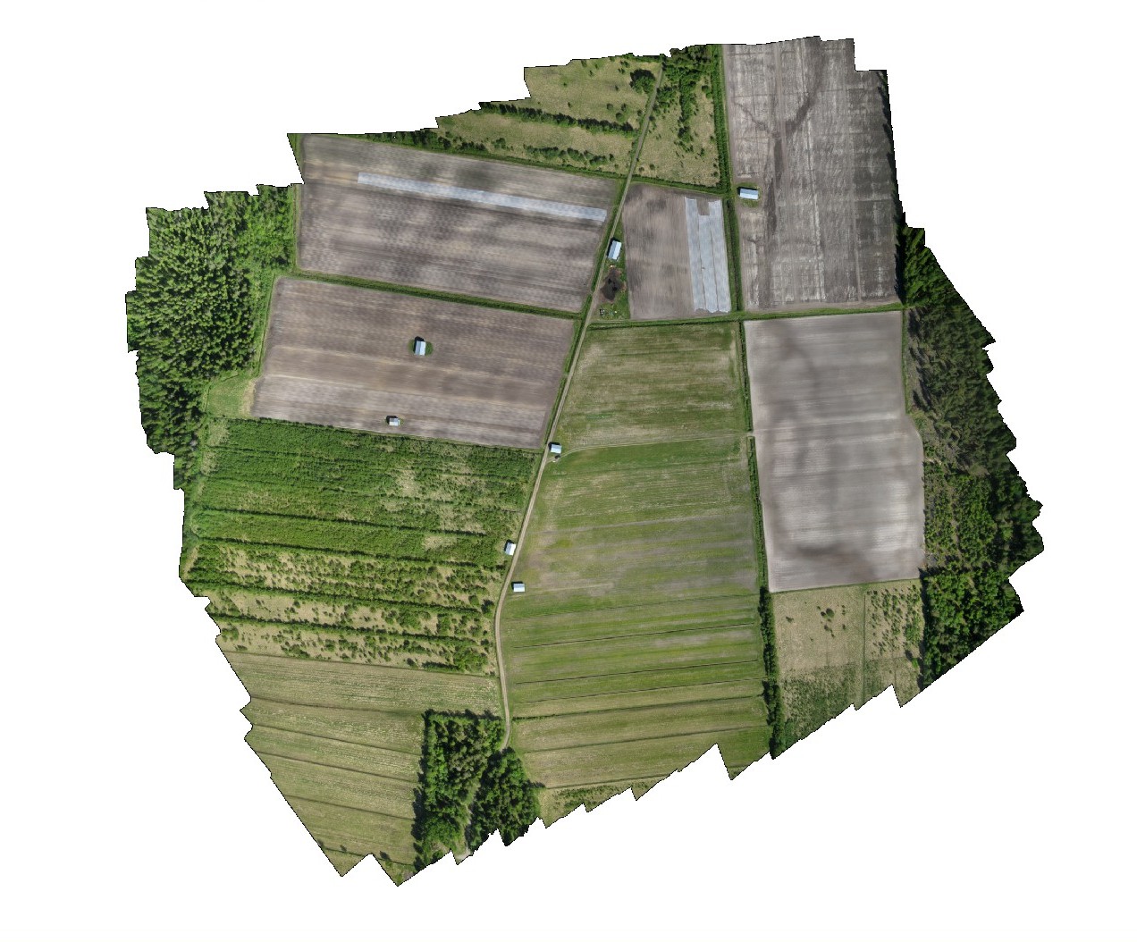
Highly automated aerial mapping software produces georeferenced photo mosaics on-site directly after the flight in less than 15 minutes.
The propriety developed software enables you to see the entire job stitched together prior to leaving the job site. This clearly shows any areas that may have been left out or need additional flying. This file can then be passed onto PhotoScan Pro for completion of the DTMs and other mapping applications.
A typical mission covers 35 to 65 ha at 5cm resolution from 120m altitude flights, take approx 30 minutes for 60ha – all autonomous (hands off) and several missions can be run for larger areas.
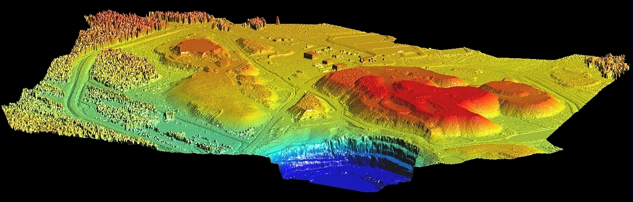
After PhotoScan Pro or other point cloud packages have reduced the photos, the data can then be exported to a surveying package to produce a final (to scale) plan, contours, volumes etc.